Thursday, June 25, 2009
We had quite the adventure yesterday trying to drive to the campground. The directions google gave us lead us down a county road and then onto an unimproved/unmaintained road down Calico Draw... We got stuck 4 times and had to do some fancy pushing/digging/praying to get out. When we finally got to the end it was gated and we had to take the gate off its hinges to get by. All in all it took us an extra hour and a half but was an awesome adventure. Were launching today and will be on the river for 5 days. I may have service and may update from there, we'll see.
Tuesday, June 23, 2009
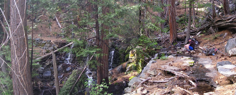
Sawtooth Photo Album
Here's a link to the Facebook album as per usual: http://www.facebook.com/album.php?aid=2198312&id=19700119&l=1e71323b84
Panos and trip report will be up in a week after we get back from rafting.
Until then here's a video preview:
Nighty night,
George
Panos and trip report will be up in a week after we get back from rafting.
Until then here's a video preview:
Nighty night,
George
Updates
Hey All,
Just finished writing the Yosemite trip report, it's a doozy. Val is kind enough to edit it for me and save you from reading 2000 words of unintelligible garbage. The Shasta trip report will be shorter... Anyways we are about to take off for a week to raft the Yampa river and unfortunately I won't be able to get anything online until after then. However, look for a million updates right after that. Here's my IOU: 4 trip reports (Yosemite, Shasta, Sawtooths, Yampa), 2 sets of images and panos (Yampa, and the Sawtooths which are actually coming up right after this post!)
In other notes: I got a new camera and it takes magnificent pictures. So get excited...
Love,
George
Sunday, June 14, 2009


Wednesday, June 10, 2009
Shasta Album and Panos
Shasta Photo Album here:
http://www.facebook.com/album.php?aid=2195613&id=19700119&l=0dd06d36f6
 Red Bluffs and The Heart from Helen Lake
 Casaval Ridge from Helen Lake
 View from Helen Lake
http://www.facebook.com/album.php?aid=2195613&id=19700119&l=0dd06d36f6
 Red Bluffs and The Heart from Helen Lake
 Casaval Ridge from Helen Lake
 View from Helen Lake
Tuesday, June 9, 2009
Mount Hood Trip Report

Let’s try this again… Trying to plan this trip presented two distinct obstacles: timing it appropriately so that we have safe conditions on the hike up and good conditions to snowboard down. Since my first experience on Hood had been during the icefall disaster weekend I was expecting the conditions to be along those lines and thought that we would need to primarily plan around safety and then just somehow figure out how to time the descent for the best conditions. My immediate thought: four-hour summit nap.
The more I read and the more I talked to people however, the more it became apparent that the conditions two weeks ago were the exception and not the norm. From various people’s accounts those were as bad icefall conditions as they had ever seen. I asked about timing for a ski or snowboard descent, and how to time it to be safe on the way up and fun on the way down and the response was overwhelmingly, plan it completely around the descent and the conditions will be fine.
Now the “standard” thinking on Hood, is that to have a “safe” ascent you start around 1 am, summit at sunrise, and descend through the crater by the time the sun has started to hit it and soften things up. Now I am all about safety, and more importantly not getting killed, but one thing I have noticed from my time interacting with the climbing community is that a lot of people (or at least a very vocal minority) are overly insistent about safety measures. In this case about the fact that you must start hiking by 1 am to have a safe ascent of Mt. Hood. However, the most important thing on Hood, and - really almost everywhere - is to accurately judge the conditions on your own or from others’ reports and be smart about what you are doing. With this in mind we decided to make a summit attempt about 6 hours after conventional wisdom would dictate.
We left Corvallis around 3 am, about 45 minutes later than we had planned. Our original plan had been to start hiking around 5 am, summit by 9, and to be back at the lodge by noon. If this went according to plan I was going to snowboard for the afternoon and then head back to Portland to have Val switch the car with James and meet up with my mom for the afternoon in Portland with my cousin.
We arrived at the mountain at 5:30 just as the sun was starting to rise. I did a quick count of the people up on the hill already and lost track between 50 and 60. We started to pack our stuff and quickly decided on a new plan. I had a season pass to Timberline and at 8:00 the lifts would open and save me 2 hours of hiking. James had no desire however to pay $52 dollars for a lift ticket just to ride the lift up once. After a brief nap, at 7:00 am, James started hiking up the traditional route. We had decided to consolidate our stuff into one backpack, which I would take up the lift with me at 8:00 and then carry with my snowboard attached to the Summit.
The plan worked beautifully and I met James at the top of the Palmer lift (8600 feet) at 8:40 am. James was feeling good from being able to hike with no pack, and I was feeling good from an extra few hours of sleep and not hiking for 2 hours. While we were on track to be at the summit a few hours late the snow was still firm enough that hiking was easy, and as we talked to people coming down almost everyone said there was no appreciable rock or icefall.
We moved pretty quickly up to the hogsback where we took a break to have some food and reapply sunscreen. There were a few parties on their way back down and a few more hanging out on the hogsback waiting to go up. Most of the people headed up at this point in the day were either skinning up or had skis on their packs. There was a dad with two kids, decked out with bike helmets, jeans, and old school leather strap crampons. The kids were a strange mix of excited and terrified, mostly terrified.
We traversed across the bottom of the crater, as has been the popular route since the crazy icefall a few weeks ago. This new route takes you right up and over some really active volcanic vents, pumping sulfur filled air into your already oxygen deprived lungs. Once you get back on snow it is a moderate snow climb up to the summit ridge. The most popular route heading left through the widest area of the Old Chute, avoids the looming seracs as much as possible. The top few hundred vertical feet of this route is literally a set of stairs kicked into the snow, evenly spaced, about a foot deep and a foot tall and 5 feet wide. We found this kind of curious and sprinted up the last couple hundred feet of these stairs singing the rocky theme song. Only to be gasping for air at 11,000 feet once we got to the ridge.
The Old Chute presents a much more exposed traverse than the Pearly Gates route did. The Pearly Gates route essentially dropped you off right below the summit with only a mellow snow climb between you and the top. The Old Chute tops out a couple tenths of a mile from the summit with one stretch where the ridge is maybe two feet wide where a fall to either side would end very poorly.
We cruised over to the summit and snapped some awesome mandatory summit pictures. We had the summit to ourselves for a few minutes (one of the benefits of climbing later in the day) before a couple other people got up there. There was a pair of guys, one of whom had just summited for the 107th time. (He is actually writing a book about all of the ski lines on Mount Hood.) We talked with them for a while and they said I could tag along with them over to where they were going to ski down. As you can imagine skiing down a staircase wouldn’t be much fun, so they were going to traverse farther west before dropping into a different headwall.
We hung out for about 30 minutes on top before we headed back down. James via the route we came up, and I via the West Crater headwall. I was the first of our group of four skiers to drop in and swept a handful of a adrenalin filled turns before traversing over to the hogsback and making a giant surf slash right above some cute German girls and meeting back up with James.
The snow everywhere had softened up well at this point. I cruised back down to Palmer spraying everyone I could get near, including a helpless James who was flying down the glissade chutes on his pool float. The only real excitement was sinking in, catching my front edge and slicing my finger on some ice once partway down.
By the time we got back down to Palmer, James was beat. And justifiably so, he had hiked 2500 extra vertical feet, and had to down climb much of what I had been able to snowboard, all this on top of being slightly sick and not sleeping at all the night before. He asked the ski patrol guys if he could download on Palmer and he explained that he felt ill and might have mild altitude sickness. They replied that he would have to be really sick to get a ride down.
Our next genius plan was for me to snowboard down giving James a piggyback ride. This was mildly effective… We could go for a couple hundred feet before I couldn’t hold him anymore and had to take a break. We did this 5 or 6 times, the last time culminating in me catching my front edge and face planting with James riding on my back. Shortly after that we abandoned the idea, it was actually a miracle that we didn’t get hurt from that fall. Although it would have been ironic for the ski patrol to tell James he couldn’t ride down only to have to rescue two people later because they wouldn’t let him ride down.
We made it down to the top of the Magic Mile lift, where James asked again if he could ride down and he was greeted with the same reply, even though they do allow downloading on the Magic Mile... At this point I took the backpack back from James and cruised down to the lodge and tried to get some water and food for James because he was feeling really bad at this point. Only to have all of the food service in the lodge closed for the day, and only able to afford one $2.75 16 ounce PowerAde from a machine.
James made it down a few minutes later and collapsed into the car. We headed back down to the Portland area and met up with my mom, cousin, and Val.
Mount Hood Photo Album and Panoramas
Check out the Facebook photo album here:
http://www.facebook.com/album.php?aid=2194682&id=19700119&l=179e66a19e
And the full quality panoramas here (as always click for full size image):
 Crater Rock and the lower Hogsback from farther west in the crater
 East of the Hogsback in the crater
 Mount Saint Helens, Mount Rainier, and Mount Adams (left to right)
 Climbing up the Old Chute
 More expansive, but worse quality, picture of Crater Rock and the Hogsback
http://www.facebook.com/album.php?aid=2194682&id=19700119&l=179e66a19e
And the full quality panoramas here (as always click for full size image):
 Crater Rock and the lower Hogsback from farther west in the craterEast of the Hogsback in the crater
 Mount Saint Helens, Mount Rainier, and Mount Adams (left to right)
 Climbing up the Old Chute
 More expansive, but worse quality, picture of Crater Rock and the Hogsback
Tuesday, June 2, 2009
Were in Yosemite right now. About to take off on a three day 31 mile backpacking trip along the north rim of Yosemite Valley.
I have a trip report written for the Mount Hood trip but haven't had internet access and haven't been able to post it. Ill get that out when were in Sacramento for a couple days this weekend.
Subscribe to:
Posts (Atom)